
Place Your Videos on the Map
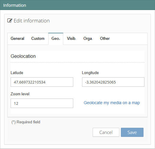
In the Streamlike console, the “Information” widget includes a “Geo” tab with a link that opens a map where you can pinpoint the media’s location very precisely, including by entering an address.
If you plan to place multiple videos on the same map, add them to the same playlist.
Building a GeoTV
A web TV with a map-based interface is called a “geoTV.” Instead of searching for videos in a list or by keywords, you find them on a map. Here is a very basic example:
As we explained in a previous article, this “GeoTV” was generated with a single prompt, refined by an additional request (“group nearby videos into a single tile, display their count, and show the videos when the zoom level allows them to be distinguished”). Here are a few ways to improve it:
- Use multiple playlists to select the content displayed. For example: “Sailing,” “Rowing,” “Speedsail”…
- Add a dynamic filter to show only videos whose title, description, or keywords contain a specific string of characters,
- Vary the diameter of the tiles based on criteria such as the media’s duration, number of views, publication date, or a custom field,
- color the outline of a media thumbnail based on the playlist it belongs to,
- visualize relationships between media items (shared keywords) using connectors between thumbnails,
- etc.!
Placing a Video on a GPS Track
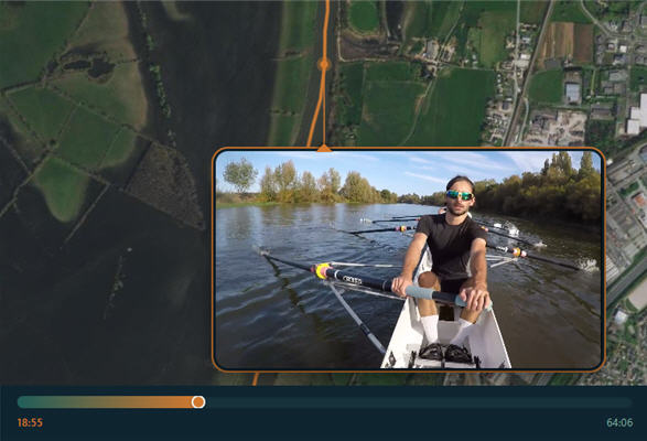
This other example involves displaying both a horizontal view with the video and a vertical view (satellite or map) by dynamically positioning the video on a track. In other words, it involves synchronizing a video with a .fit or .gpx file recorded by a GPS device, a smartwatch, or a smartphone. A “timeline” (progress bar) at the bottom of the page allows you to move the video along the track, and conversely, moving the video’s playhead repositions it on the track.
For our example, we used a video and track recorded during a rowing race in Angers, France. Every time the boat passes under a bridge, every turn, and every phase of the race is visible from the onboard camera or from the sky, as if a drone were following the boat directly overhead. The map background (the satellite view) automatically orients itself according to the boat’s direction.
Using this same model, we can create a sort of “Street View” to offer a virtual tour of a hiking or running route—on foot or by bike—or to explore a tourist attraction.
Here again, there are many ways to optimize the experience. The only limit is your imagination.